Motorcycle Adventures 2015
Season Track Map
1629 Miles Riden this year

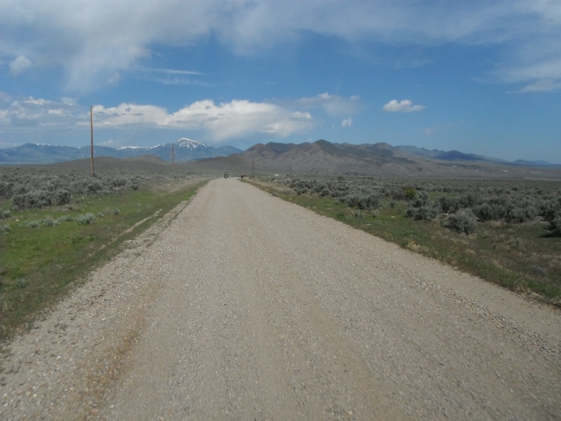
6/8 - Day Loop
My original plan for this ride was to go out Trinity Ridge and ride along the Roaring River. The day before, I learned from another group that Trinity Ridge Road was still snowed in. I was able to find another route that would be a little lower elevation and hopefully we would be able to get through.There were 4 of us on this ride Dan, Dave, Wayne and myself.
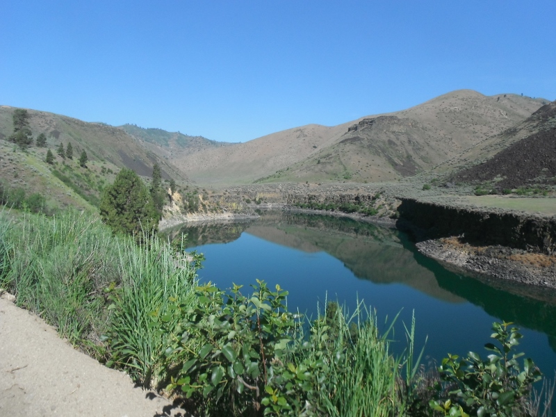
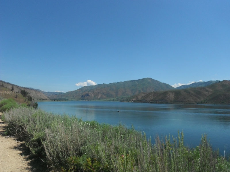
Arrow Rock Reservoir was dead calm
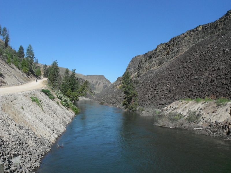
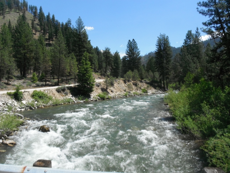
Looking down stream on the South Fork of the Boise River
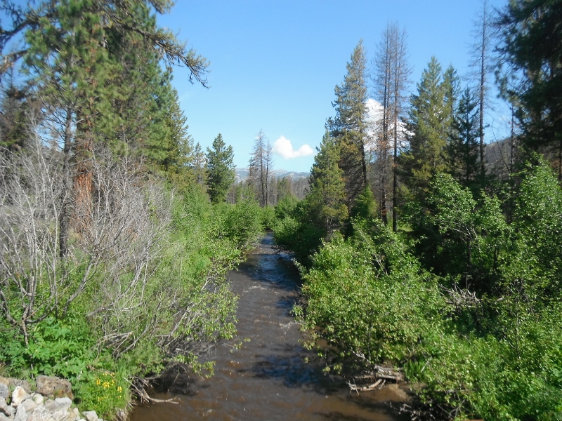
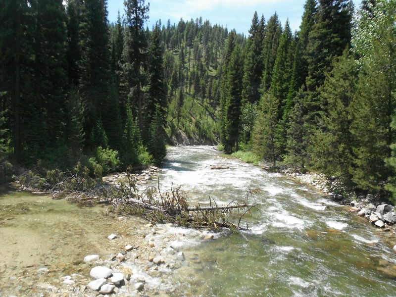
Fall Creek at Trinity Ridge Road
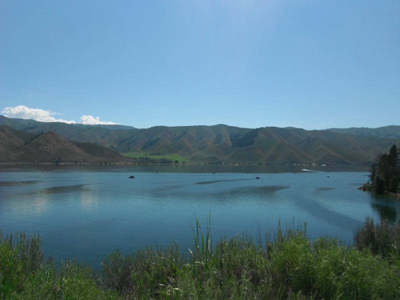
Anderson Reservior is completely full
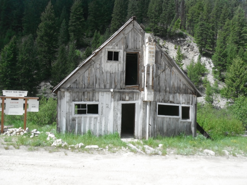
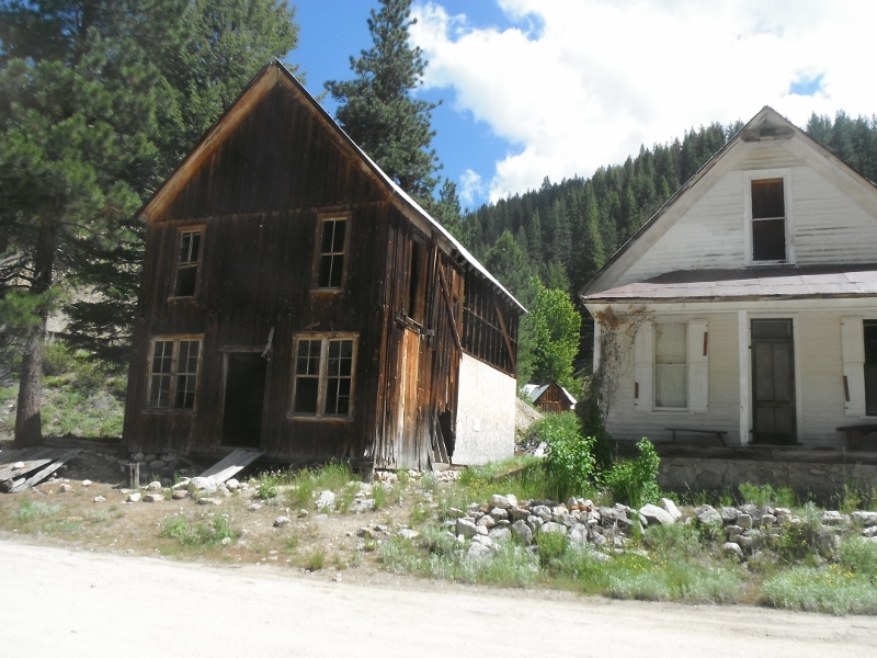
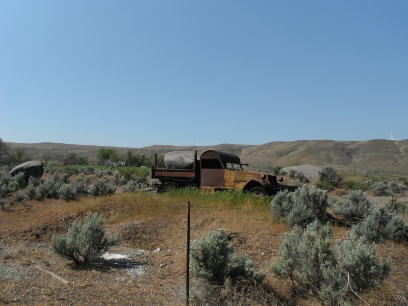
Some old buildings at Rocky Bar
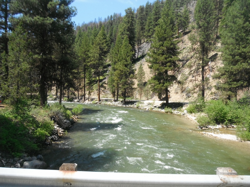
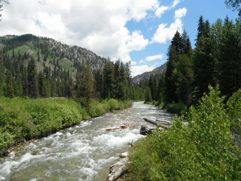
Looking down stream on the Middle Fork of the Boise River
...and up stream. It's running pretty good still.
Looking up stream on the North Fork of the Boise River
...and down stream
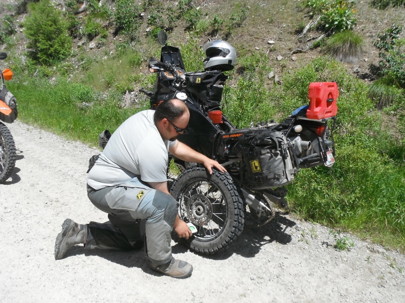
I turned the wrong direction when we crossed the North Fork. After riding for a little way things didn't look familiar. I stopped to figure out where I had gotten off track. After waiting for a while, the group had not caught up to me. I figured they might be waiting for me to realize I was heading the wrong direction, so I went back to find them. It turned out that Dave had a flat tire. They already had the tube changed out and were ready to put the tire back on when I got there.
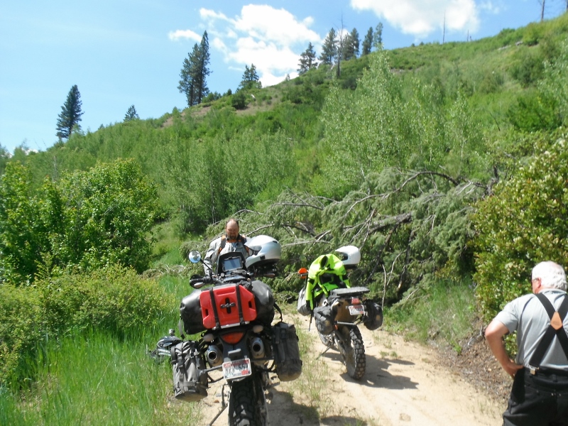
On our way into Idaho City, we decided to take a side loop up German Creek. We came around a corner and found this tree down across the road.
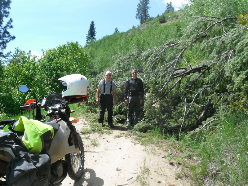
It was really green, so there was no way to break any branches off to get around. The end of the tree hung over the edge and the prospect of having a bike tumbling down a steep incline convinced us to turn around and go back the way we came.
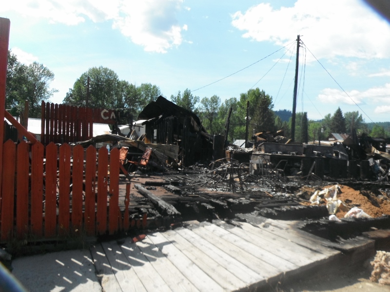
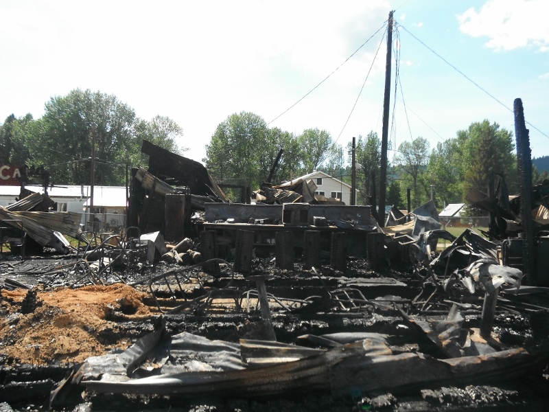
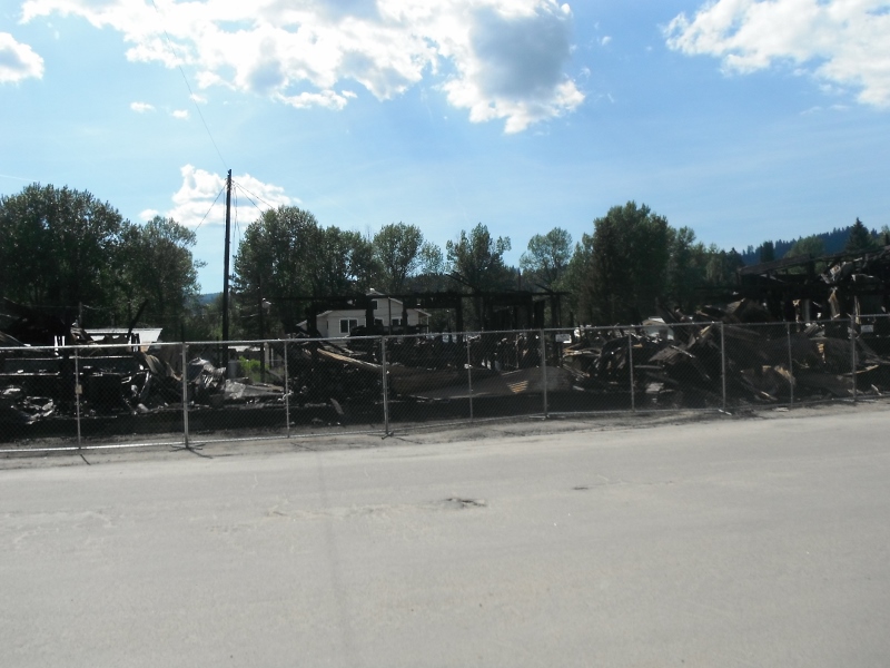
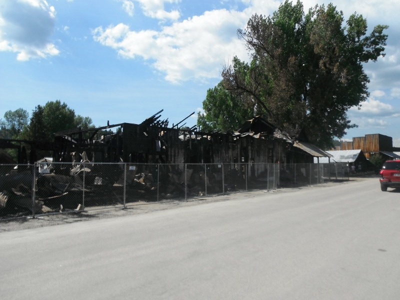
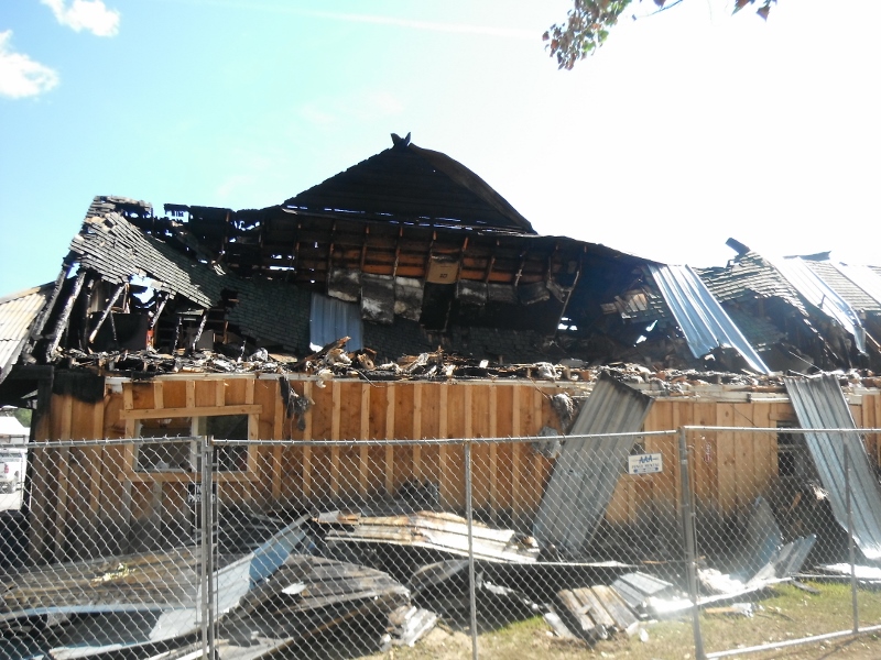
There had been a fire earlier in the week in Idaho City. The boardwalk and several businesses on Main St. were heavily damaged.
5/1 through 5/3 - Promotory Point and Transcontinental Railroad Ride
This was the first overnight ride of the season for me. There were a total of 12 riders in the group.We rode 800 miles in 3 days.
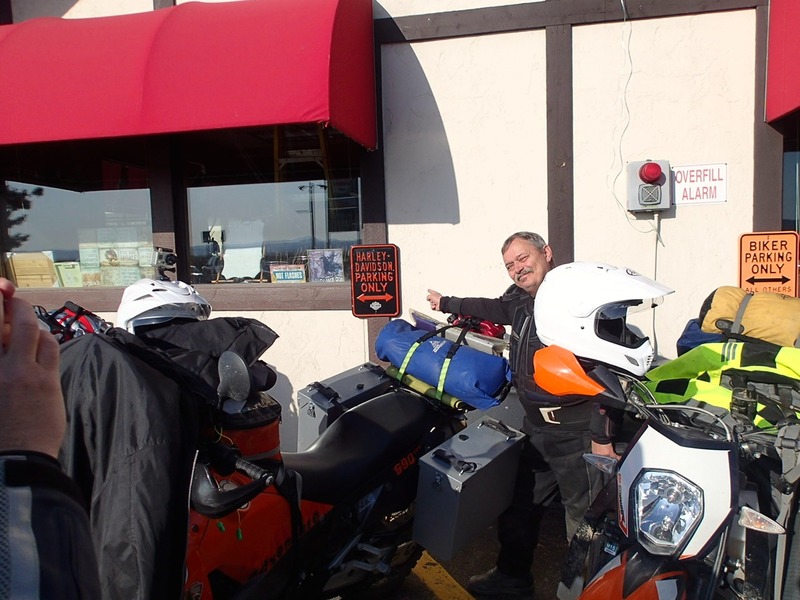
We met up at the Boise Stage Stop for breakfast. Sam Stone, the group leader is pointing out that our bikes might be parked in the wrong place.
Photo by Craig Olsen
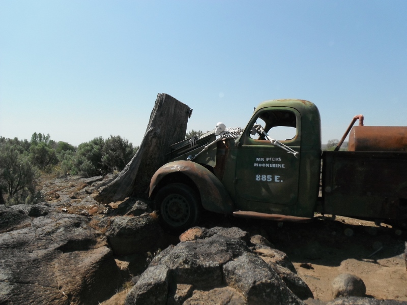
An old truck along the way. If you look closely you can see that it is chained to the large rock on the left of the photo.
This is another old truck outside of Hagerman.
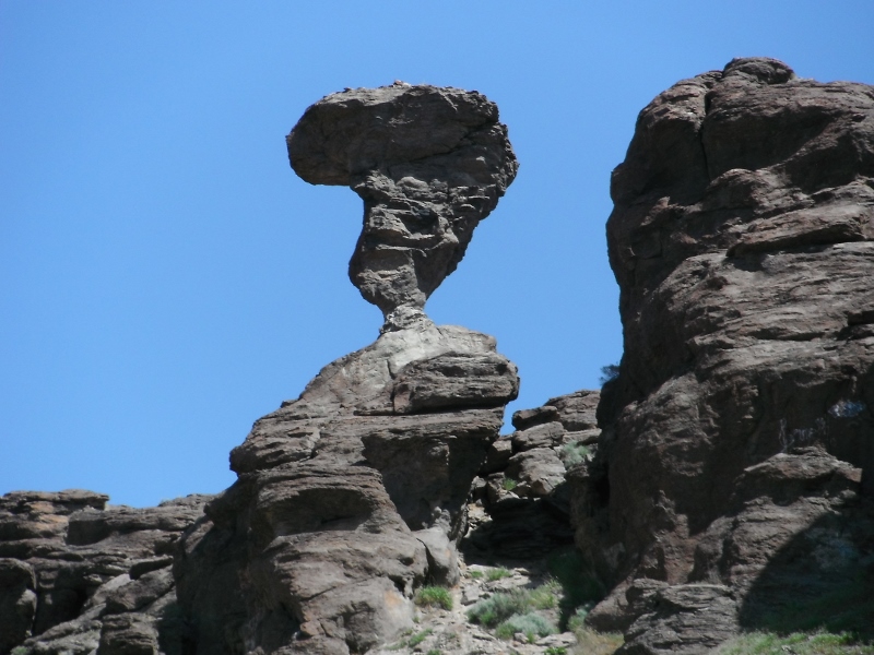
We stopped at Balanced Rock just outside of Twin Falls.
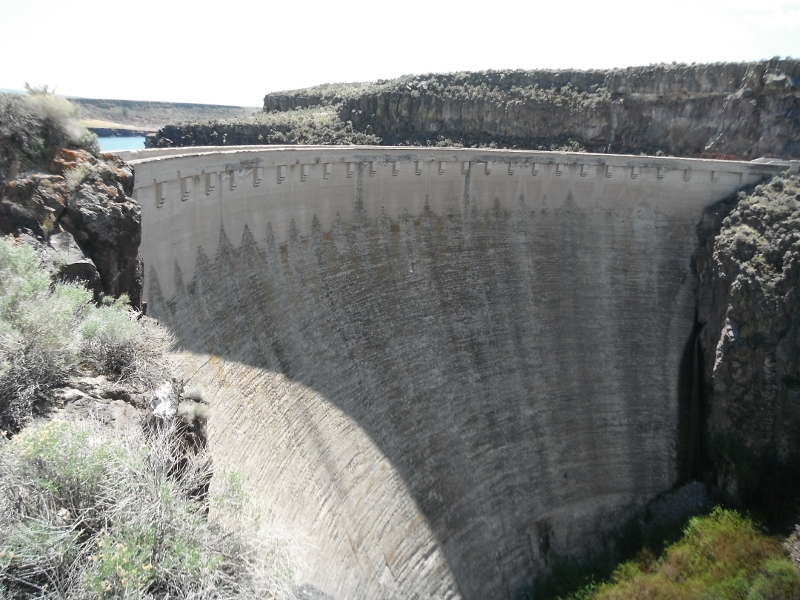
This is the dam at Salmon Falls Creek Reservior
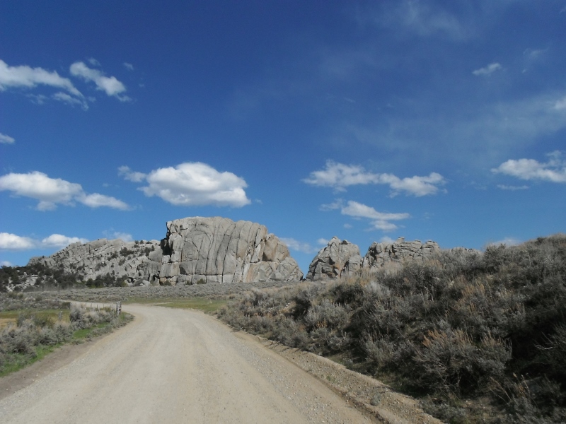
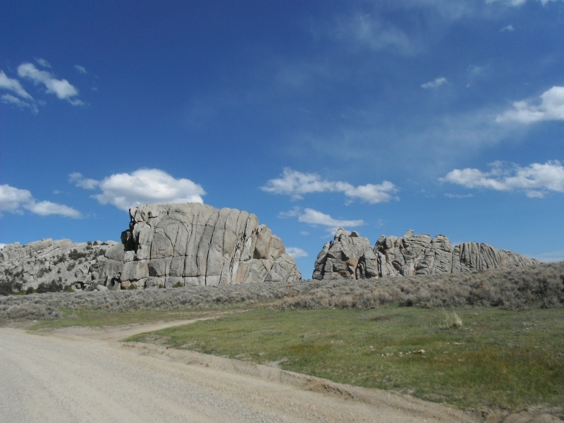
This is on the way into The City of Rocks
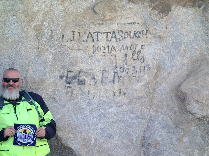
The City of Rocks was a stop on the old Oregon Trail. The "graffiti" that you see on the rock was put there by travelers of the old trail. It was written in axle grease and is still clearly visible today
Photo by Craig Olsen
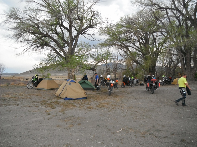
Setting up camp Friday night at the old town of Lucin, Utah.
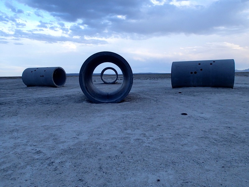
We took a short side trip Friday evening to an art exhibit out in the middle of the desert called the "Sun Tunnels".
Photo by Craig Olsen
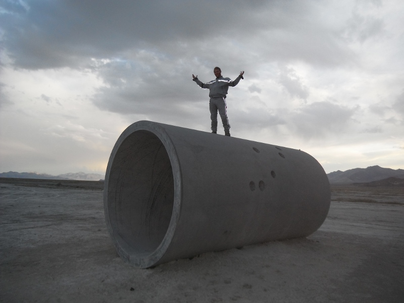
Matt standing on top of one
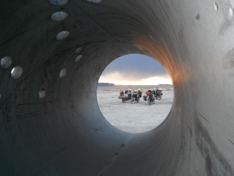
A view of the sunset through one of the tunnels. You can see some spiral marks on the inside of the tunnel. We figured out that they were made by someone shooting bullets at just the right angle so that they would spin around inside the tube.
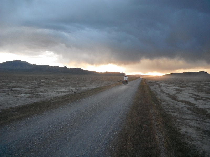
Sunset on the way back to camp
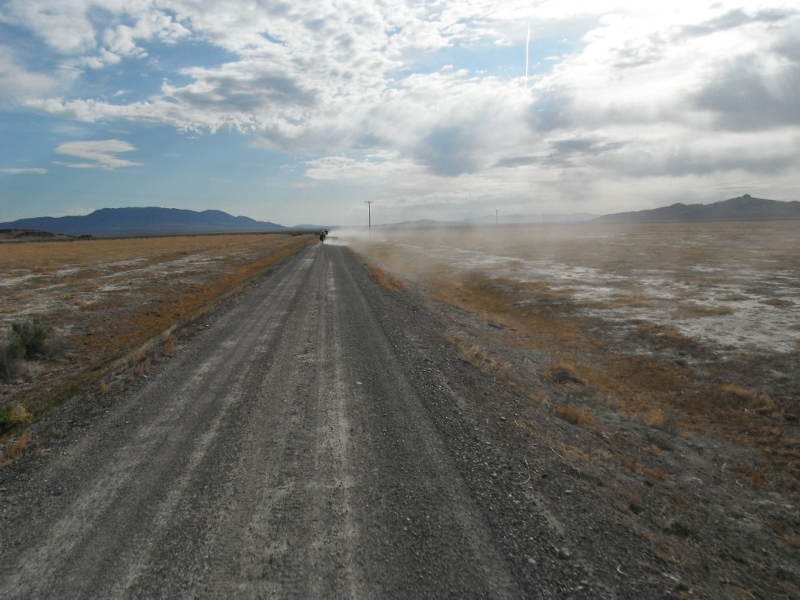
Saturday morning we broke camp and headed out along the old Transcontinental railway grade.
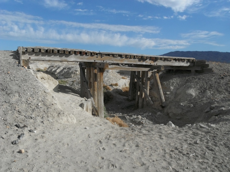
There were a number of old trestles along the way. They were remarkably sturdy for 150 year old wooden structures.
This is the creek bed on the other side of the trestle.
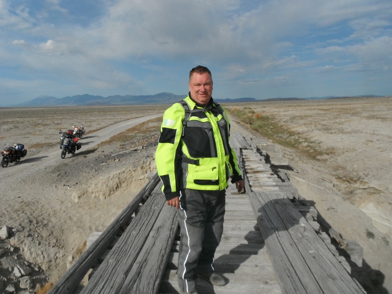
Like I said, they are remarkably sturdy...
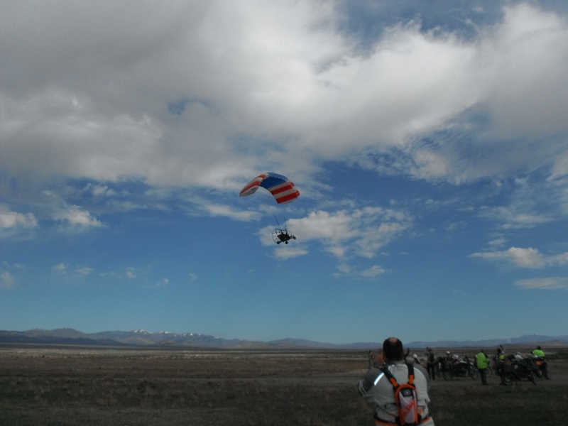
We were buzzed by a local in a powered paraglider.
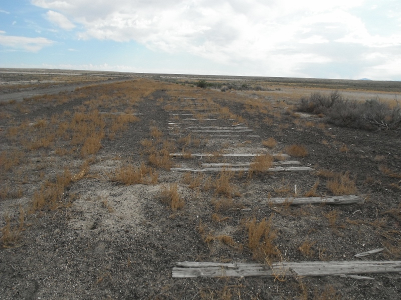
Old railroad ties left from one of the sidings.
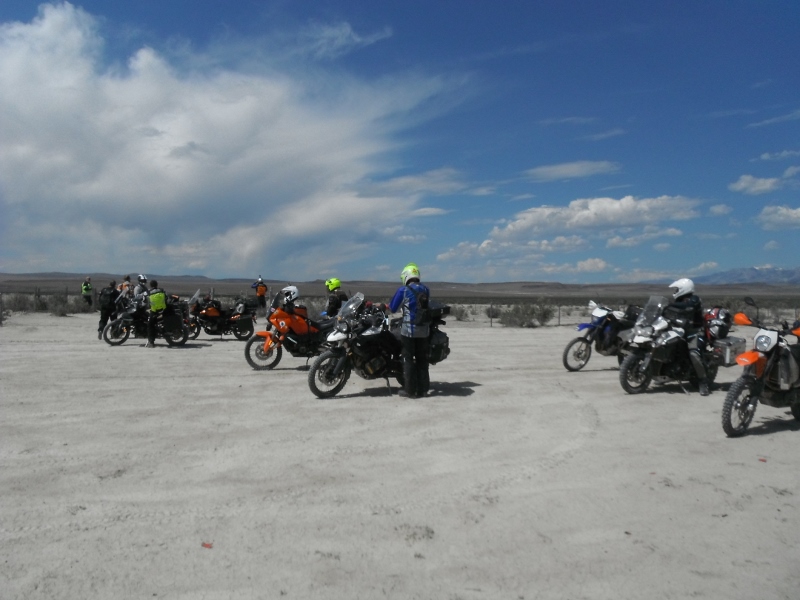
Stopping for a break
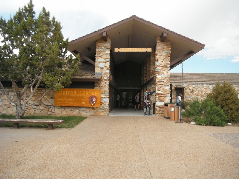
The visitor center at the "Golden Spike National site". This is where the two rail companies connected their routes from the east and west.
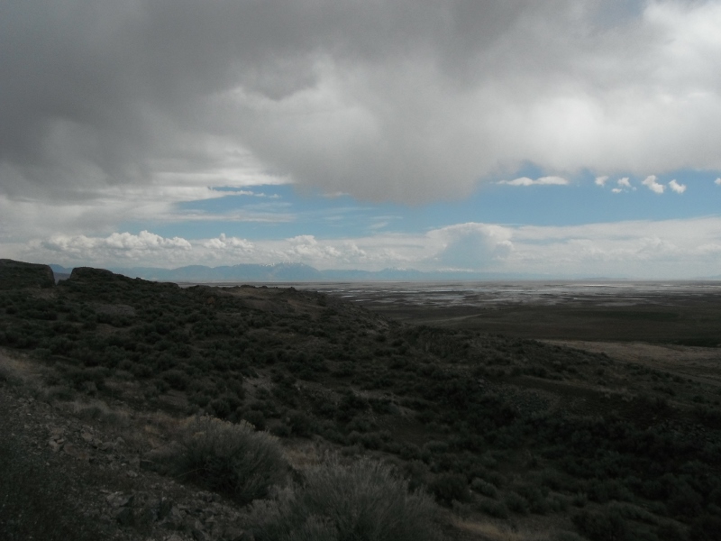
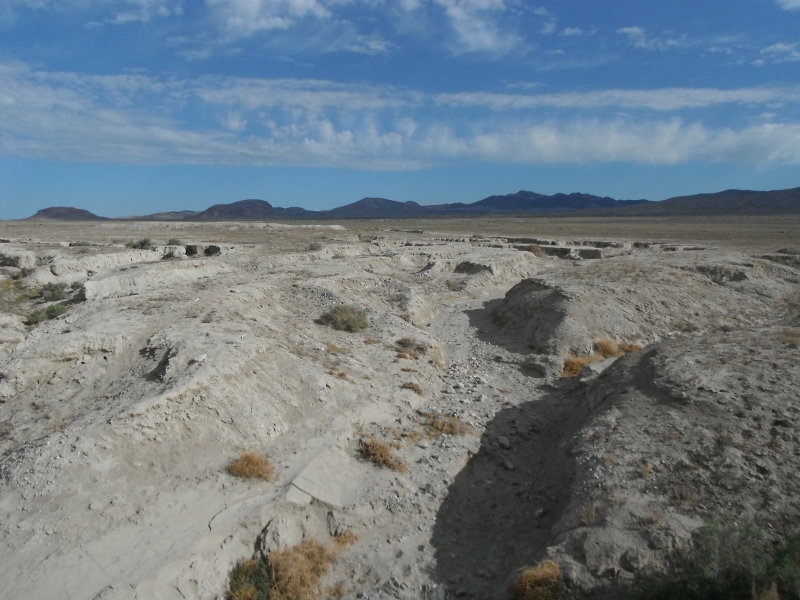
This is a view of the edge of the Great Salt Lake from the old railway grade.
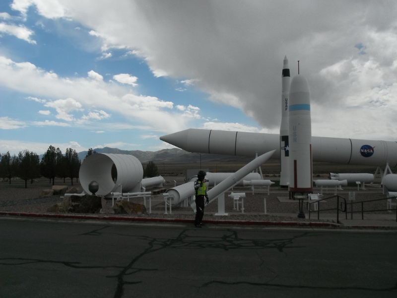
Just outside of Brigham City, Utah is a company called ATK that makes rockets.
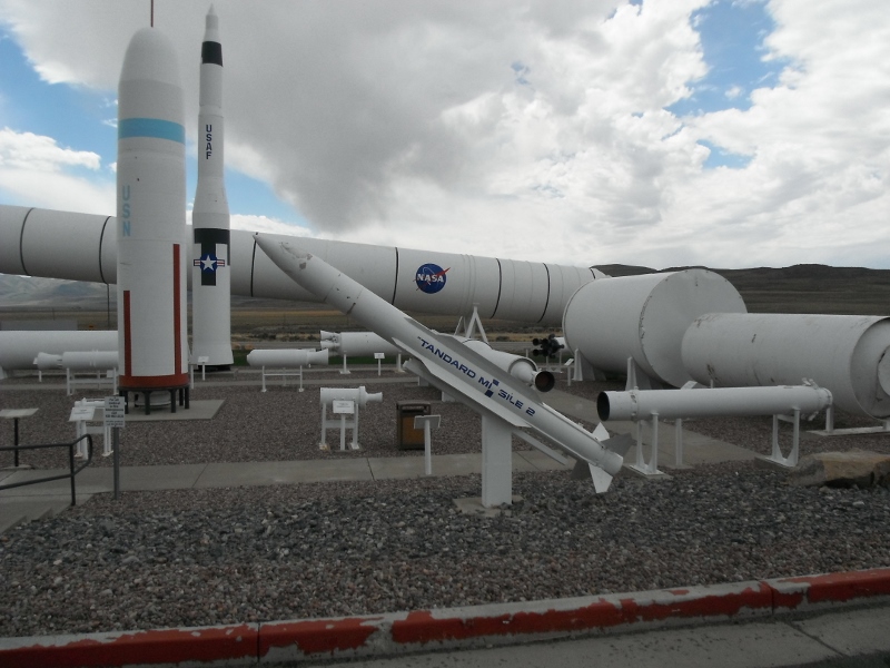
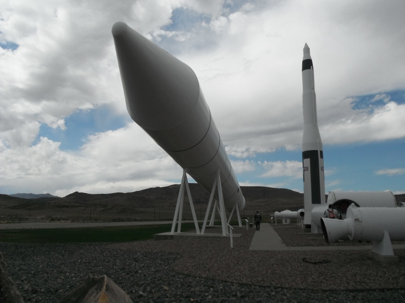
This is one of the Solid Rocket Boosters that were used on the space shuttle.
Sunday morning breakfast in Snowville, Utah
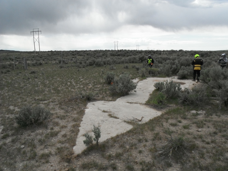
These concrete arrows are scattered across the country. They were used as navigation markers in the early days of Air mail delivery.
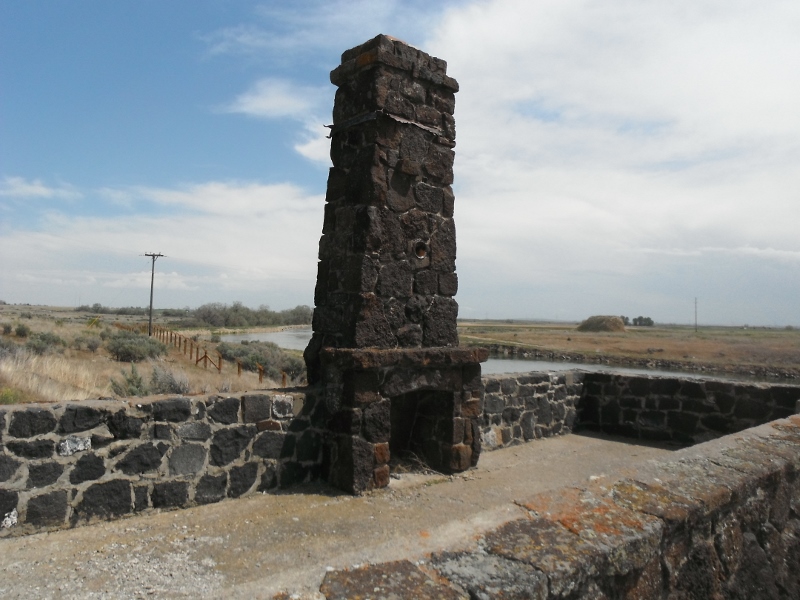
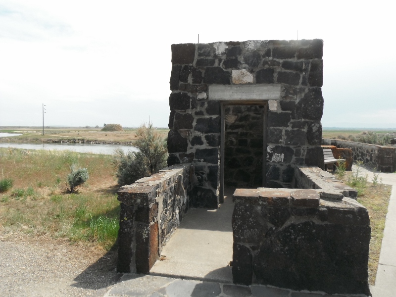
On our way back toward Boise, we stopped at the site of the Minidoka Internment camp. This is where our country "invited" Japanese people to stay during World War II. This chimney was part of the Reception building
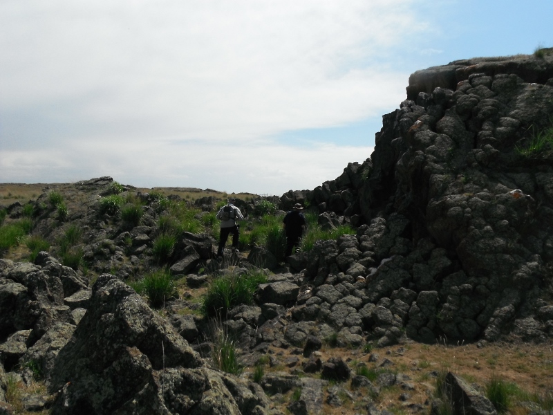
We took one more side trip on our way home. This is Wilson Butte Cave. The cave entrance is to the right of where the guys are walking.
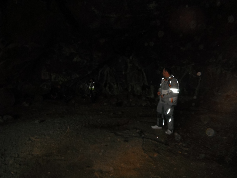
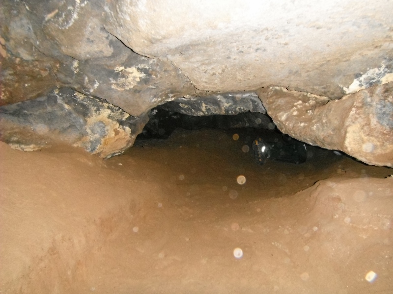
This is Dave standing in the first chamber of the cave. It's difficult to see, but Thane is kneeling down at the opening to the second chamber.
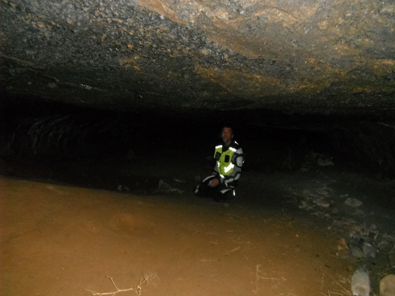
Thane and I decided to crawl into the second chamber and have a look around. There was quite a bit of room in here, but it was too short to stand up.
This is Thane crawling into the third chamber.
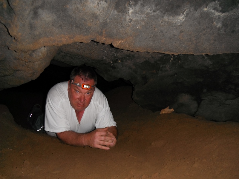
I'm crawling through the opening into the third chamber. We were getting far enough in, that there wasn't any natural light anymore and the group was outside waiting for us, so we decided that was enough cave exploration for this trip.
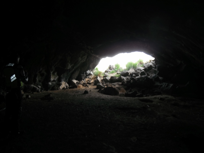
Looking out of the opening to the cave.